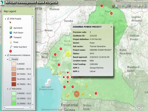
More news for those who like their data served up on beautiful maps. AidData has been working with the African Development Bank (AfDB) to map the Bank's activities on the continent. You can check out the results so far with this map, created with support from Esri. The Bank launched it at their Annual Meetings last week in Lisbon, where it also reaffirmed its commitment to increasing the transparency of its work.
The map shows the AfDB's ongoing operations in three countries: Cameroon, Morocco, and Tanzania. This represents a subset of the more than 2,000 activities financed since 2009, and represents newly geocoded project data (in addition to the AfDB projects that were coded last summer as part of the Mapping for Results partnership with the World Bank, which can be seen through the Development Loop app). With the map, you can zoom in on each country and explore the Bank’s activities by sector, against underlying maps of key development indicators by subnational region (including poverty, malnutrition, and infant mortality rates).
To create the map, AidData researchers identified the latitude and longitude of the location(s) where each project is being implemented, using the geocoding methodology developed jointly with Uppsala University in Sweden.