In 2006, AidData’s Co-Executive Director, Nancy McGuire Choi, was in Haiti at a meeting with an Economic Adviser to then President Preval. She remembers vividly how the President’s adviser articulated with great emotion some of the challenges facing the government of Haiti’s line ministries. One of the biggest roadblocks at that time was that the government lacked sufficient data on how, and where, donors were spending their money. “My Minister of Health,” he said, “estimates that he has no actionable information about at least a third of all health activities in Haiti. He doesn’t know who is doing what, where in Haiti. Haiti’s not a big place, but it sure can feel like it when you’re flying blind.”
Flying blind is not an effective way to do business, yet somehow “data poverty” remains a major obstacle for many partner governments in Africa, Asia, and Latin America. The private sector learned the value of tracking their investments many years ago, as companies realized that investing in data and analytics would enable them to drive down costs and bring greater precision to product delivery and customer satisfaction.
But if the return on investments in data and analytics is so large, then why has the global development community not placed the same emphasis on data and analytics?
AidData has been working in close partnership with USAID’s Global Development Lab to create a “new normal” where policymakers and practitioners ask themselves “why would we not use data and analytics to maximize the impact of every development dollar we spend?”
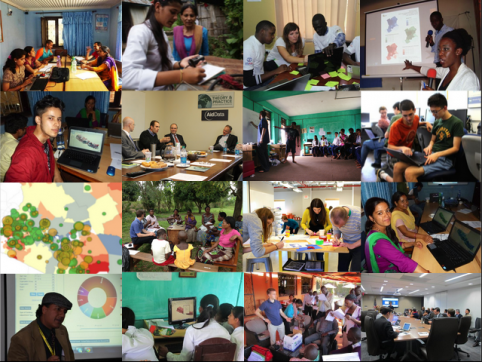
We are beginning to see significant progress. Following the pioneering efforts of the World Bank’s Mapping for Results Initiative in proving the concept of geocoding, the Government of Malawi and AidData piloted the first-ever comprehensive geocoding exercise of the universe of aid in one country in 2011. Since then, a growing number of partner countries in Asia, Africa, and Latin America (e.g. Haiti, Senegal, Uganda, DRC, Nepal, Timor-Leste, Honduras) have jumped on the geocoding bandwagon with support from AidData and USAID’s Global Development Lab.
We have also witnessed accelerating institutional adoption of subnational georeferencing by the World Bank, the African Development, the Asian Development Bank, USAID, and other development partners. AidData has worked with many of these partners over the last several years to geo-reference more than 85,000 development projects around the globe worth more than $650 billion. During this period of time, AidData’s geocoding methodology was also adopted as the first geocoding standard of the International Aid Transparency Initiative (IATI).
However, while creating a foundation of high-quality data is a critical and necessary first step, it is not sufficient by itself. There is no Field of Dreams. The mantra should instead be, “If you build it, they still might not come.” To transform decision-making and data use, we need more than supply side interventions.
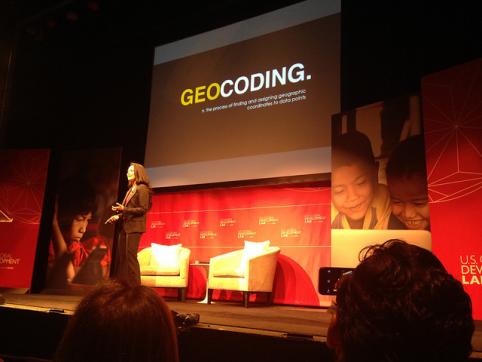
Former AidData Research Associate Pat Austria speaks at the launch of USAID’s Global Development Lab in April, 2014.
We need to not only produce and publish high-quality data, but also invest in new technologies and capacity building efforts that facilitate data use by decision-makers, civic monitors, and ordinary citizens. We need to find ways to help the scientific community more effectively partner with policymakers and practitioners in the field so that cutting-edge methods can be brought to bear upon contemporary development challenges. And we need to enable people all around the world to participate in the emerging “geospatial revolution” and use geocoded aid information to promote development effectiveness and accountability in their own communities.
Throughout this 4 part series, we’ll tell you more about our 5 year partnership with USAID, as well as the rapidly growing network of partners across Asia, Africa, and Latin America that have joined this effort. In tomorrow’s post, we’ll talk about the innovative technologies and research that we’ve been working on to leverage geospatial data for better decision making. Then, we’ll share how we are trying to foster a global community of data users, and finally we’ll summarize some of our key lessons learned and describe where we’re headed in the next two and a half years.
We’re excited to share our work with you, and look forward to hearing how we might work together in the future.

