Bangladesh can be described as “ground zero” at the intersection of climate change and food security.
The country is widely recognized as one of the places most vulnerable to the effects of a changing climate, which strains food systems alongside rapidly growing and urbanizing populations. Yet, despite these dual challenges, the World Bank expects Bangladesh will meet its Millennium Development Goal (MDG) of halving the number of people living in extreme poverty by 2015.
Given the impact of the global food crisis and numerous natural disasters, how is Bangladesh managing this feat? And can we map the country’s progress?
Questions like these are being tackled by an expanded Mapping for Results initiative that allows mash-ups between development indicators and project locations. AidData, a joint initiative of Brigham Young University, the College of William and Mary, and Development Gateway, is working with the World Bank to roll out 80+ new country maps and corresponding data during the Spring Meetings.
Mapping results in Bangladesh shows how swiftly Bank support has been distributed to reach people in need, and in locations where impact is greatest.
In late 2007, for example, food and fuel prices began increasing globally as the country recovered from a monsoon that affected almost half the population and internally displaced 11 million people. Then disaster struck a second time. A massive cyclone hit another half of the country’s districts and affected 8.7 million citizens.

This map shows the locations of the $383 million in Bank disaster response projects from 2008-2011 against a base map of the most disaster-prone areas in the country. Project locations are spread throughout damaged areas in the Western part of the country, with special concentration in the hard-hit Ganges Delta.
Rapid disbursements helped alleviate suffering and supported rebuilding shelters and coastal embankments. Notably, projects to secure clean water and prevent further flooding were launched in the population center and capital of Dhaka.
Food Crisis Response
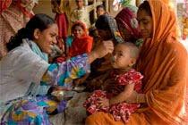
The related food issue was not forgotten. Many disaster recovery projects contained components to regain lost production from agriculture and fisheries.
Despite recovery attempts, the magnitude of devastated harvests and livelihoods created another disaster: food prices in markets soared. Many Bangladeshis were forced to cut meals from their daily diets, eat lower quality food, and wait for hours in government queues for relief.
Again, the Bank responded with nationwide projects designed to improve food security through expanding access to agricultural technology, strengthening water supply, restoring livelihoods in disaster-affected areas, reducing environmental degradation, and improving municipal services throughout the country.
Achieving food security amid a global price crisis and challenging national conditions demanded investment beyond the hundreds of millions already devoted through disaster response.
The Bank committed an additional $593 million from 2008-2010. Projects were spread evenly across the country; larger disbursements focused on areas where population was densest.
Here, projects are mapped against a backdrop of recorded malnutrition levels by CIESIN:

The circles, dots and shaded overlays as seen on these maps represent a strategy in action at the confluence of food and climate change, an area critical to keeping the MDGs in sight.
Long-term projects to strengthen food systems and defend against the effects of climate change in Bangladesh are available in the Bank’s mapping portfolio by sector, at maps.worldbank.org/sa/bangladesh.
More solutions to the global food crisis will be discussed at the Open Forum, an April 14-15 global online discussion on the food crisis. Submit your own idea inspired by maps or your own experiences.
Related Story: Mapping for Results: Democratizing Data