What do you see when you look at the picture below? Did you know that each component of this charming countryside is also a piece of spatial data?

When using Geographic Information Systems (GIS), geographic features can be expressed as vectors, meaning they are translated into points, lines and polygons that can be mapped and visualized. AidData’s geocoding methodology creates point data by reading project descriptions to identify precise project locations.

Point data is useful for identifying a precise latitude and longitude or understanding the distribution of projects at a macro level. However, incorporating lines and polygons expands research possibilities. For example, lines represent features that are inaccurately depicted by points, such as rivers, roads and transmission cables. If you want to assess long-term impacts of changes in land use or find optimal routes for access roads, then you need line data.

At this time, our collected data and the AidData 3.0 GIS portal does not explicitly support line or polygon data, but there are several methods of creating useful visualizations of points. Take for example, a road-related project. We carried out this conversion process by using the Network Analysis function in ESRI’s ArcGIS software and by incorporating data from Open Street Map. Open Street Map is especially valuable for finding data from developing countries, as these countries often lack official street data. The conversion process is easy and the results provide a useful base layer to extend data analysis. As an example, consider this construction project in Burundi.
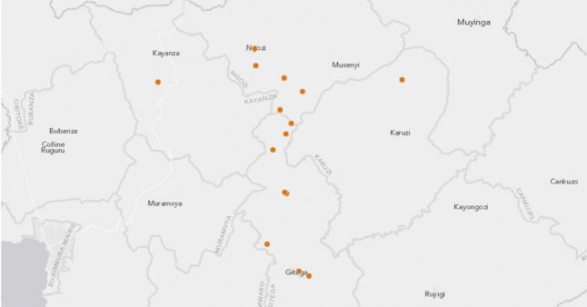
The image above shows a transportation project in Burundi as it currently appears on the AidData 3.0 GIS portal. While the points allude to the road’s possible location and length, it requires the user to mentally “connect the dots.” For this project, incorporating a line to represent the road would add clarity. Combining the point data and Open Street Map road lines inside the AidData 3.0 GIS Portal results in this map:
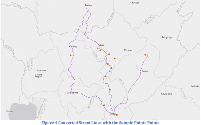
With these roads now in place, we can also begin to ask spatial questions, such as, “How many projects occurred within one mile of an existing road?” As AidData’s portfolio of projects expands, extending our data beyond points will help make data more intuitive and visual for users.
If you are familiar with ArcGIS and want to try uploading a similar conversion to AidData 3.0, we used ESRI’s ArcGIS Online “Roads Africa” shapefile and the AidData 3.0 GIS Module. For more information on completing the conversion process, email info@aiddata.org.