Until recently, most Americans might have regarded themselves as water-rich, awash in H2O. But as the Colorado River dries up, Western states are consumed with the political, economic, and environmental ramifications of a disappearing resource. According to the Nature Conservancy, the past two decades have been the driest or the second driest in the last 1,200 years in the American West. Disappearing water is affecting constituencies as wide-ranging as power companies and recreational boaters, from restaurant-goers not being automatically given a glass of water to suburbanites facing lawn-watering restrictions.
Yet it is farmers in particular, who work the millions of acres served by the Colorado River, that face some of the worst economic hardship. They are being forced to make tough decisions on which crops to plant—or whether to plant at all.
To some, like historian Norris Hundley, the problem stems from an avoidance of science going all the way back to 1922, when water allocations among states were first made: “They had a glaring need for sound information, but no concerted attempt was made to call on the scientific community for help. The drafters were mesmerized by their desire for haste and their political and personal goals. Without authoritative data, they had an opportunity to pick and choose information that best suited their interests and uncertainties. And that is what they did.”
But the problem is not confined to just the Colorado River or the United States: 72% of the world’s population is currently water-insecure, and the situation is worsening. According to the UN, in half the world’s countries, one or more types of freshwater ecosystems are degraded. River flow has significantly decreased in many countries, surface water bodies are shrinking or being lost, and water management systems are struggling to cope.
Away from these domestic headlines, an AidData team of economists, geospatial analysts, data scientists, and trained research assistants has spent the past decade studying the effectiveness and impacts of aid-funded irrigation projects in some of the most remote, underserved regions of the world, where water is in chronic short supply. Along the way, they have built a body of evidence and methods focused on irrigation investments in developing countries—with an aim to help farmers and the local communities they serve, including through innovative and wise uses of water.
This ongoing effort includes three geospatial impact evaluations (GIEs) currently underway in Cape Verde, Ethiopia, and the Philippines, in partnership with the Rome-based International Fund for Agricultural Development (IFAD).
Much of AidData’s research in this sector has been in partnership with aid and development organizations like IFAD, which for years have promoted drought- and climate-resilient agriculture through irrigation programs. In an era of declining aid budgets and increased scrutiny that makes every dollar precious, having innovative methods at hand to understand and communicate what works and what doesn’t is crucial.
“Measuring the long-term outcomes of development interventions is critical for ensuring sustainable results, learning, and accountability,” said Ariel BenYishay, AidData’s Chief Economist and Director of Research and Evaluation. “Yet it remains a challenge due to implementation timelines, methodological constraints, and data availability. Amid growing pressure from donors for development banks and international finance and aid institutions to demonstrate sustained impact, the ability to track long-term change has become a strategic priority.”
This month, AidData is delivering to IFAD the first results of the three GIEs it is implementing as part of a $370,000 project (“Tracking Long-Term Sustainability of IFAD Projects through Geospatial Impact Evaluation”) that runs through October 2027. IFAD is the only UN agency exclusively dedicated to transforming agriculture, rural economies and food systems, investing in the millions of people who are most at risk of being left behind: poor, small-scale food producers living in rural areas, often in the most remote and fragile contexts.
“These investments in irrigation by IFAD are vital, because they are meant to enable farmers to grapple with a changing climate and apply water more efficiently across the agricultural season,” said BenYishay. “Often, their impacts are also clearly visible from satellites and other types of remote sensing, as newly irrigated fields appear distinctly greener during key windows in the growing season. This is where we come in.”
For the GIEs, the IFAD team is supplying project, ground survey, and crop data and has partnered with AidData to conduct causal inference analysis—measuring what improvements can actually be attributed to a program—plus provide local contextual insights to improve interpretation. The results from these evaluations will inform IFAD’s strategic and operational objectives.
“This collaboration will help us evaluate long-term development outcomes, going beyond short project cycles and allowing us to understand what persists, what fades, and why,” said Leonardo Rafael Corral Rodas, Chief of the Evidence for Development Impact and Innovation Unit at IFAD. “Working with AidData is an opportunity to learn and inform IFAD’s future project design, integrating monitoring and evaluation data with Earth Observation (EO) analysis from the start, ensuring that geospatial analysis is systematically embedded in IFAD’s operations. The continuous nature of EO data is a huge advantage, allowing us to track land cover and productivity trends before and after climate shocks, showing how communities withstand and recover from them, and quantifying the impact of IFAD projects in making climate stress more tolerable and building resilience.”
Some of IFAD’s projects began as long ago as 2008, while others wrapped up just three years ago. “IFAD invests heavily in irrigation to boost agricultural productivity and make farming less dependent on rainfall variability, but the full benefits of a project often unfold years after it closes,” said Cristina Chiarella, a Senior Economist in IFAD's Office of Development Effectiveness. “By using geospatial data, we can complement self-reported outcomes with measures of vegetation health and water availability derived from satellite imagery, and track how these investments perform over time.”
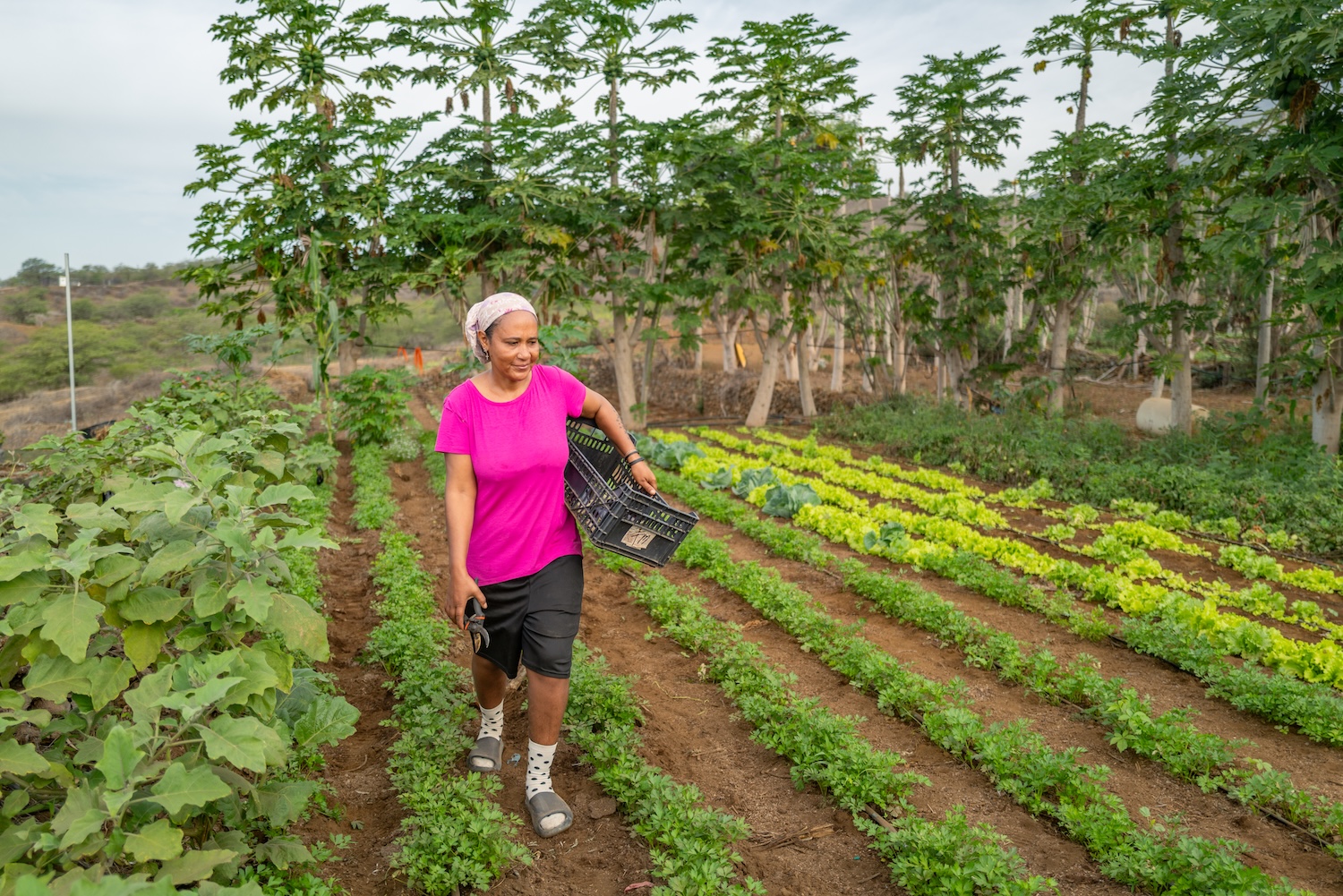
One of the three countries where research is underway is Cape Verde, or Cabo Verde, where just 10% of land is arable and the country is beset by drought. In 2013, IFAD and the government of Cabo Verde launched the $40 million Rural Socio-economic Opportunities Programme (POSER) project. It built irrigation infrastructure and provided training to increase and diversify the production of climate-resilient crops. Early results have been promising, suggesting the program has helped thousands of local farmers diversify the crops they grow and then get them to market. The GIE underway will allow IFAD and AidData to evaluate the full program using robust tools and technologies, as well as large sources of data.
“Satellites and other types of Earth Observation (EO) can extend impact evaluations beyond just the time periods and locations covered by ground-based data, including cases where field observations are limited or unavailable. Where both sources are available, they can also be used together to strengthen confidence in the findings,” said Sara Sayedi, a Postdoctoral Fellow at AidData who has been leading the Cabo Verde GIE since spring of this year. “Moreover, many outcomes relevant to climate change are increasingly measurable through EO, including land degradation (damage to the health and quality of soil), vegetation change, surface water conditions, and terrestrial carbon stocks (how much carbon is stored in plants and soil). These measures can expand the scope of our impact evaluations. In Cabo Verde, where many farms are small and quite different from each other, we use 10-meter-resolution Sentinel-2 data and seasonal vegetation patterns to examine broader trends in crop diversity, the mix of plants that farmers grow, over time. This provides a consistent way to assess how diverse (or not) crops become over time, which is relevant to POSER’s broader objectives to strengthen rural livelihoods and climate resilience.”
Meanwhile, Yuntian Bi, a Geospatial Analyst at AidData, is working on two GIEs focused on the Philippines and Ethiopia. In the former, she is studying IFAD-funded irrigation canals in a mountainous, northern rice-growing region in Luzon, called the Cordillera Administrative Region, studying crop greenness and surface water. She is looking at a 60-hectare ‘treated’ plot of land, where irrigation canals were built, and comparing it with 1,800 hectares of untreated or ‘control’ land. From 18,353 pixels of imagery, more than six million observations were generated, which Bi will filter, aggregate, and analyze.
Beyond just increasing the household incomes of farmers, including by building value chains in niche markets, the IFAD-supported irrigation projects in the Philippines aimed to improve land tenure (the legal system that determines land ownership), food security, and watershed conservation, recognizing the rights of indigenous peoples to manage the natural resources in their domains. “A key challenge we face is conducting rigorous evaluations in data-scarce environments, where reliable ground data is often limited or unavailable,” said Bi. “Our approach focuses on using satellite-based indicators alongside careful comparison design so we can capture the actual effects of irrigation investments and distinguish them from broader environmental variation, such as rainfall and seasonal dynamics."
GIEs leverage innovations in data collection and processing, plus satellite and drone imagery, rigorous econometric methods, and geospatial computing capacity to generate insights that can complement those drawn from traditional ground-based evaluations.
GIEs also allow researchers to study remote or fragile areas. Collecting this data through household surveys would be prohibitively expensive, while recent advances in geospatial technologies, high-resolution satellite imagery, and increased analytical capacity have opened up new, cost-effective opportunities to evaluate development programs. In the absence of “ground-truthed” (verified, accurate data taken from direct observation), or with only limited survey inputs, the AidData researchers have been using Landsat and Sentinel satellite imagery, as well as more precise Google Earth data at higher resolutions.
“Our partnership with IFAD marks a transformative advance in applying geospatial science to sustainable development,” said Kunwar Singh, AidData Senior Geospatial Scientist. “This kind of rigorous evidence, cutting-edge methods, and collaborative leadership can shape agricultural policy and enhance the long-term effectiveness of development investments. By combining satellite-derived crop mapping with environmental metrics, we are developing scalable methods that provide unprecedented precision and actionable insight for agricultural impact evaluations.”
Another objective of the current project is to assist IFAD staff to design, commission, and interpret GIEs in-house. “This collaboration with AidData will build IFAD’s internal capacity to implement geospatial impact evaluations independently over time, while also ensuring that evidence generated is grounded, policy-relevant, and operationally useful,” said Corral Rodas.
AidData’s lengthy experience in the agri-food space includes serving as lead implementer of the multi-year GeoField Initiative, which is funded by the Gates Foundation. This past summer, AidData organized a major conference in Rome, hosted at the headquarters of the Food and Agriculture Organization (FAO). IFAD was one of the sponsors of the 2026 GeoField Convening, which brought together experts in climate-sensitive agriculture, Earth Observation, and impact evaluations of development.
In their book “Science Be Dammed: How Ignoring Inconvenient Science Drained the Colorado River,” Eric Kuhn and John Fleck argued that the very interventions designed to solve water security for Western states became primary drivers of the current crisis, once climate stress intensified. It’s a reminder that water-management decisions made to expand water availability, support irrigation, and promote economic development in the short term can create long-term pressures that become more difficult to manage as climate conditions change. And it further demonstrates the value of conducting impact evaluations of development programs at both short-term and long-term intervals.
“Chronic over-use of water, growing reliance on groundwater, and prolonged drought have together exposed the risks of evaluating water interventions only through their near-term benefits,” said Sayedi. “Impact evaluations should therefore consider how benefits and environmental effects evolve over time. While our current studies focus on relatively recent interventions, the geospatial impact evaluation frameworks we are developing are repeatable and relatively low-cost, making them well suited for continued monitoring. Over time, this can build the evidence needed to improve the design of development programs and help sustain benefits for communities under a changing climate.”